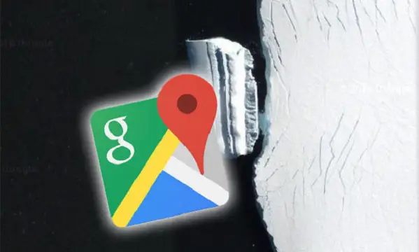
People usually go to Google Maps for educational mapping service as it offers satellite images of locations around the world. However, now and then keen observers picked up strange sightings. One photograph in Antarctica shows a lone iceberg that UFO hunters believe an underwater alien base.
Google Maps is designed for people who want to visit all areas of the world from the comfort of their turf. However, along with its informative qualities, the site also offers several entertaining images.
Seeing residential streets and national parks is just an ordinary thing in Google Maps, but many also are downright bizarre.
One particular image shows a lonely iceberg off the coast of Antarctica.
A block of ice approximately 500 metres long was discovered at the coordinate 72°43’13.53″S 78°40’21.56″W.
The iceberg seems nothing out of the ordinary apart from its placing.
However, some UFO hunters believe it is an underwater alien lair. They think it does not fit the ordinary iceberg description.
They explained that icebergs could be classified based on their shapes and forms, which are tabular and non-tabular. They observed that the shapes and forms of the iceberg in question look very different from all the various shapes and forms of tabular and non-tabular icebergs. They suspected that it could be a vessel disguised as an iceberg.

Given how Advanced,many of these Highly Evolved Beings are. I Am sure,they can.Disguise their craft in any way,shape,or form. That fits in the area they may be in.
Given how the entire continent is off limits, where only the pope, Kerry, Obama, and other global clowns can freely visit, then I think it’s pretty obvious that this is their hidden civilization and not an alien base.